Planning Approvals and Zoning on the Fleurieu Peninsula: A Guide for Developers and Investors
If your next property development project is located on the Fleurieu Peninsula, this comprehensive guide is for you. Understanding how South Australia’s planning framework, zoning regulations, and development overlays operate in this region is crucial for creating a compliant, profitable, and sustainable project.
Only 40 kilometres from Adelaide, the Fleurieu Peninsula is one of South Australia’s most desirable lifestyle destinations. The region’s coastal towns, vineyards, and rolling rural landscapes offer endless potential for residential, commercial, and tourism developments. From McLaren Vale and Langhorne Creek wine regions to seaside communities such as Victor Harbor, Goolwa, and Port Elliot, this area attracts developers, home builders, and investors seeking to capitalise on its growing appeal.
However, before you begin designing, subdividing, or building, you must understand how local zoning and overlays will shape your project’s outcome. The Planning and Design Code (PDC) is the key instrument guiding land use and development in South Australia. It outlines what type of development is supported in each zone and what restrictions may apply due to overlays like bushfire hazard, heritage, or native vegetation protection.
This guide breaks down the zoning types, overlay categories, and planning considerations specific to the Fleurieu Peninsula, helping you plan with clarity, confidence, and compliance.
Understanding the Fleurieu Peninsula’s Zoning System
The Fleurieu Peninsula features a diverse range of zoning categories under the South Australian Planning and Design Code, each designed to manage growth, protect the environment, and encourage economic development.
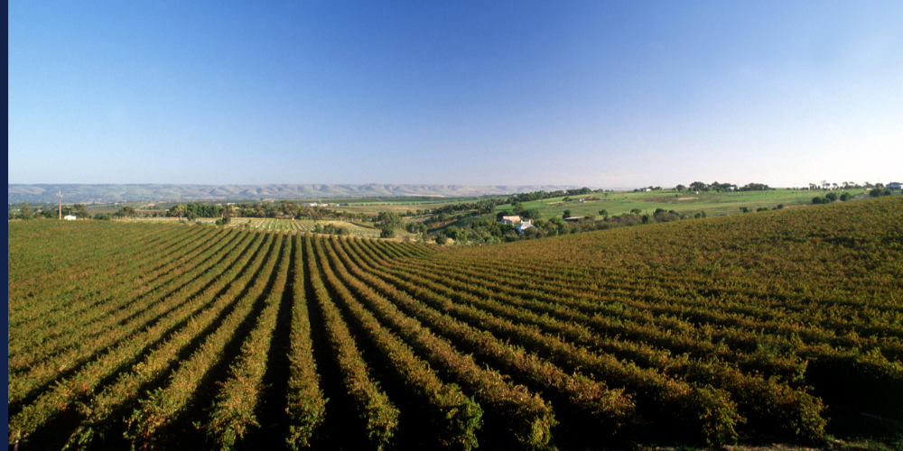
Rural Zone: Supporting Agriculture and Primary Production
The Rural Zone covers much of the inland Fleurieu region and plays a vital role in supporting South Australia’s agricultural economy. Land within this zone is intended primarily for primary production, such as farming, viticulture, forestry, and renewable energy generation. The zone encourages diversification and value adding industries such as, food and wine production facilities, farm gate sales and produce stores, small scale agri tourism ventures, renewable energy projects (e.g., solar or wind farms). Residential development is allowed but must directly support agricultural operations. For example, dwellings are typically limited to one per allotment, except in cases where additional housing supports multi-generational farm management. Small-scale tourist accommodation may also be supported, generally up to 100-150 square metres per dwelling, provided it complements the rural landscape and is sensitively designed.
Rural Living Zone: Country Lifestyle Meets Accessibility
The Rural Living Zone bridges the gap between purely agricultural and residential areas. It’s designed for people who want a semi-rural lifestyle with larger blocks, privacy, and space for hobby farming or small-scale rural activities. Typical lot sizes are around one hectare with at least 50 metres of frontage. This ensures adequate separation between properties, maintains the open character of the landscape, and supports sustainable water management. This zone appeals strongly to buyers seeking a country lifestyle close to services in towns such as Willunga, Mount Compass, and Encounter Bay.
Hills Neighbourhood Zone: Sensitive Low-Density Development
The Hills Neighbourhood Zone acts as a natural buffer between rural and urban land. Development here must respect natural topography, vegetation, and landform stability. The zone supports low-density housing designed to, follow the natural slope of the land, preserve existing trees and biodiversity, minimise excavation and visual impact, and maintain scenic views of hills and valleys. While smaller allotments are possible, site conditions such as elevation and access often determine what can be developed. Limited non-residential development may be supported if it serves the local community and aligns with environmental objectives.
Smaller Scale Residential Development Opportunities
Neighbourhood Zone: Balanced Urban Living
The Neighbourhood Zone supports residential development that reflects the existing character of the community. This zone encourages a variety of housing types to meet diverse needs, from young families and professionals to retirees. Development here should, respect existing streetscapes and housing styles, integrate landscaping and green spaces, provide safe pedestrian and cycling connections, support nearby services, schools, and shops. Lot sizes typically start from 500 square metres.
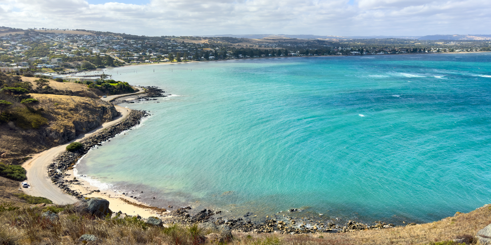
Waterfront Neighbourhood Zone: Premium Coastal Living
The Waterfront Neighbourhood Zone offers some of the most desirable real estate on the Fleurieu Peninsula. This zone focuses on residential development adjacent to water bodies, whether along the Goolwa Channel, Encounter Bay, or coastal townships like Port Elliot. Developments are encouraged to, maximise scenic views and natural light, enhance public access to the waterfront, incorporate coastal design principles and materials, and support a mix of permanent and holiday housing. Lot sizes here can be smaller, often starting from 200 square metres particularly where medium density housing or mixed-use development is proposed.
These two zones are highly sought after by those looking to build or invest in the region’s growing housing market.
Commercial and Industrial Development
Urban Activity Centre, Suburban Main Street, and Employment Zones
Commercial and mixed-use projects thrive in the Urban Activity Centre Zone, which supports regional-scale businesses, shopping, dining, and entertainment. It’s designed for walkability, strong public transport links, and vibrant public spaces. The Suburban Main Street Zone offers a smaller-scale, mixed-use setting that encourages retail, offices, dining, and medium-density housing. Its pedestrian-friendly streets and outdoor dining areas create attractive local centres. For light industrial or commercial projects, the Employment Zone is key. It supports low-impact industries and business uses that blend with nearby land uses while maintaining high visual and environmental standards.
Key Overlays Affecting Development
Bushfire Hazard Overlay
Bushfire safety is a major concern on the Fleurieu Peninsula. Depending on your site, you may fall under Bushfire (Urban Interface), High Risk, or Medium Risk Overlays. Design must prioritise safety by ensuring adequate asset protection zones, firefighting access, and compliance with Ministerial Building Standard 008 (MBS 008). Applications in high-risk areas are referred to the Country Fire Service (CFS) for review.
Heritage Overlay
Another important consideration is the Heritage Overlay, which protects the unique historic character of towns and buildings across the Peninsula. Development within heritage areas must respect existing architectural styles and materials, ensuring new buildings or extensions complement rather than dominate the original features. Engaging a heritage planner or architect early in the process can help avoid design conflicts and streamline your planning approval.
Native Vegetation Overlay
The Native Vegetation Overlay is also common across rural and semi-natural landscapes. If your project requires the removal of native trees or vegetation, you may need an arborist’s report, and in some cases, clearance activities must be referred to the Native Vegetation Council. Preserving vegetation wherever possible not only supports biodiversity but can also strengthen your development application and reduce delays.
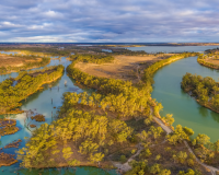
River Murray Tributaries Protection Area Overlay
Developers working near waterways should be aware of the River Murray Tributaries Protection Area Overlay, which ensures that any land division or construction near tributaries is environmentally sustainable. Projects in this overlay may require referral to the Minister responsible for administering the River Murray Act 2003.
Plan Your Development with Confidence
The Fleurieu Peninsula offers a wealth of opportunity for residential, commercial, and tourism development, but navigating the region’s zoning and overlay regulations can be complex. Working with an experienced planning consultant can help you interpret the Planning and Design Code, identify site constraints early and maximise your property’s potential.
At Certified Planning and Development Planning Consultants, we help developers, investors, and landowners:
- Identify the right zone for your project
- Interpret overlay impacts and restrictions
- Prepare compliant development applications
- Maximise your site’s development potential
Whether you’re developing a rural retreat, coastal home, or commercial development, understanding the planning framework of the Fleurieu Peninsula is the first step toward success.
Contact our team today to discuss your project and discover how we can help turn your vision into approval.
To follow along and find out more about planning issues, hear client stories or learn more about the development process make sure to read our online stories and follow any of our social media channels to stay updated. We are waiting for your call for assistance on any project requiring a planning and development consultant.